Archive | Mangroves RSS feed for this section

Blanche Harbour

8 Dec

Dear Reader:

There is a White-browed Babbler fossicking in the leaf litter which has accumulated under a small tree. Several more birds are perched in a nearby Lemon-flowered Gum watching me warily. Most of the Babblers I have encountered in this region seem to feed on the ground looking for insects, spiders, small lizards as well as fallen fruit and other vegetation.

White-browed Babbler foraging

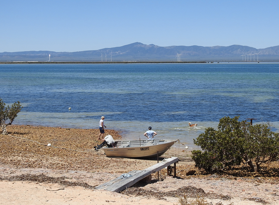
The area I am investigating has been planted out by the Blanche Harbour Revegetation Group and is at the southern extremity of Blanche Harbour which is south of Commissariat Point along Shacks Road (I wrote about Commissariat Pt in my 25th of October blog). The coast adjacent to Blanche Harbour and the army training zone of Cultana, also incorporates the Douglas Banks Marine Reserve.

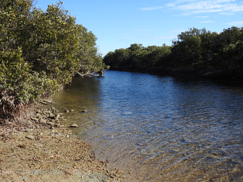
View across saltbush and mangroves

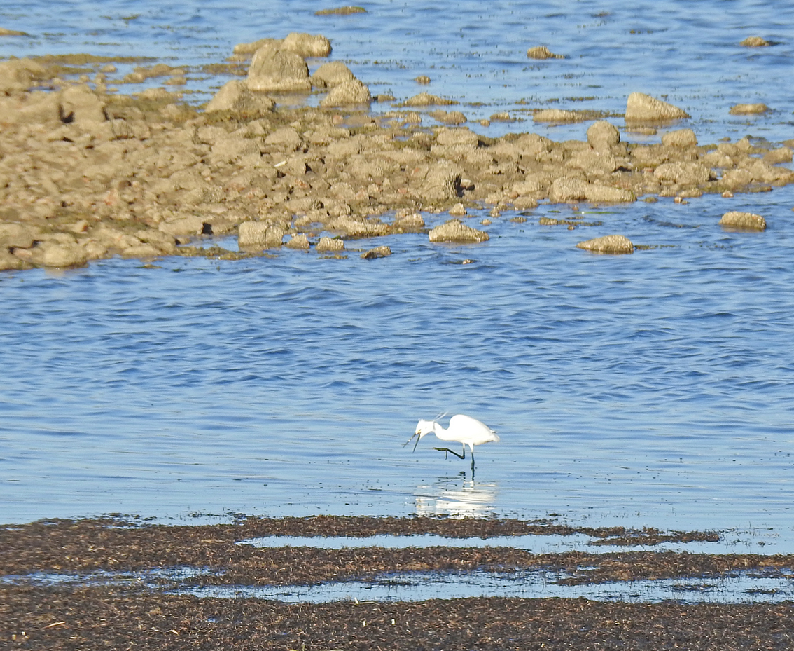
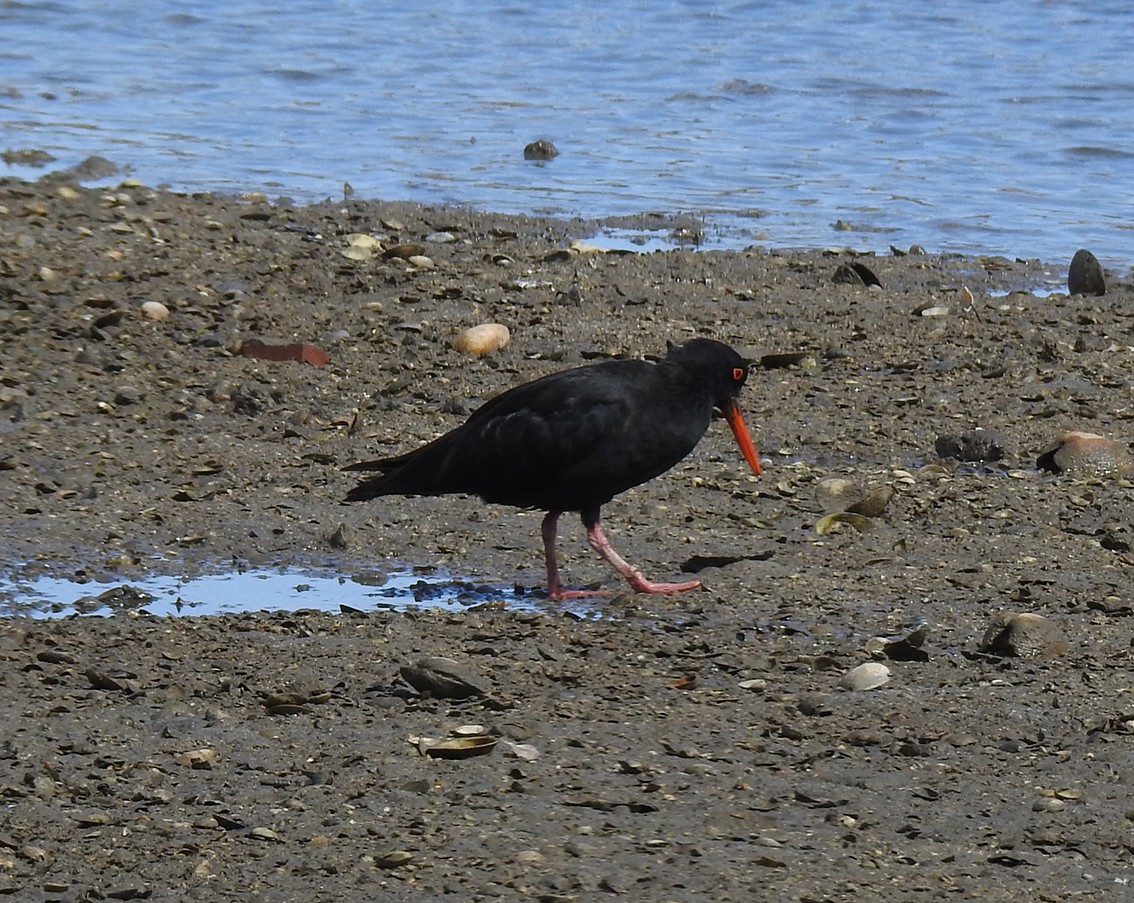
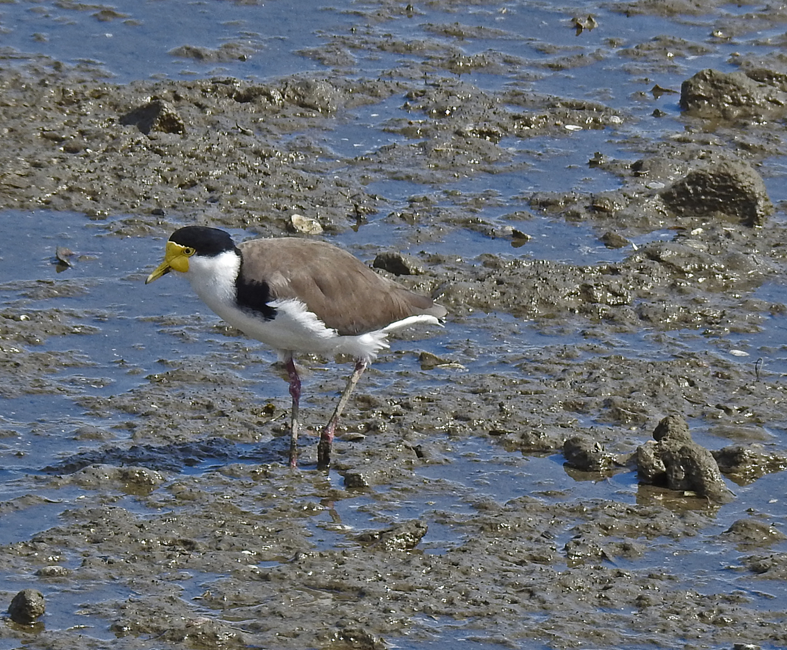
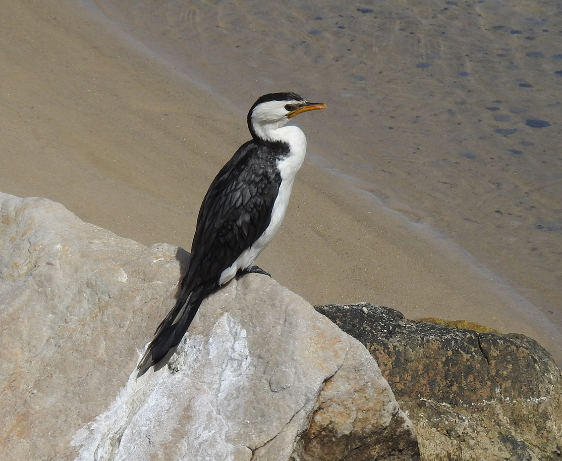
At low tide the exposed shoreline and coastal fringe is a mixture of saltbush, samphire, mangroves and exposed seagrasses.  This region is the perfect environment for wading birds ranging from herons to plovers and oystercatchers; making this an ideal birding destination.
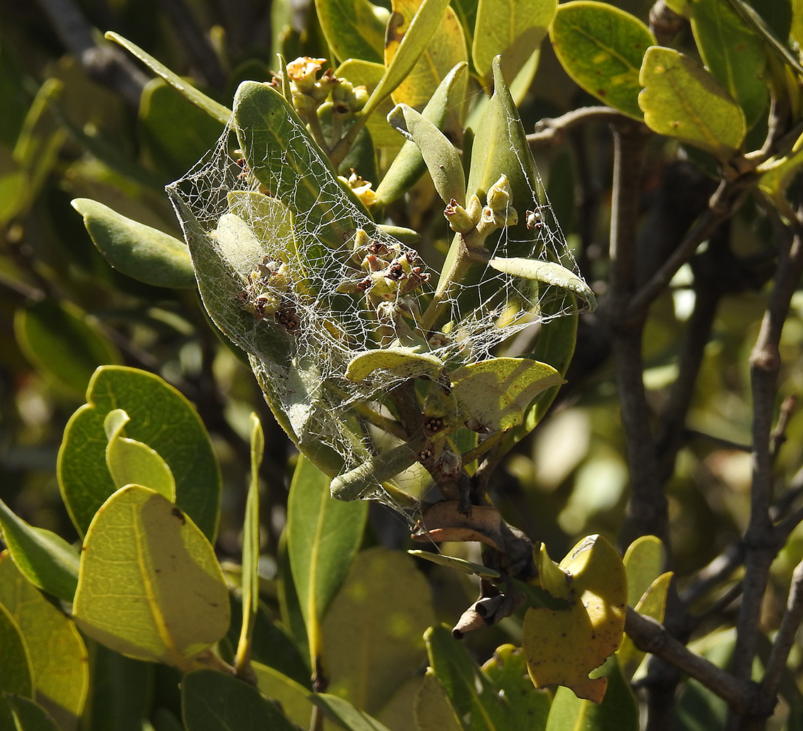
Coral Gum

Coral Gum flowers

Many of the trees, shrubs and flowering plants have been planted by the local conservation group and they are well labelled. A large shelter with excellent information displays, explains some aspects of the local ecology and provides pictures of significant wildlife.


Shelter and interpretive displays

The sun is low in the sky and photography is becoming more difficult and mosquitoes more prevalent; time to hop back in the car and head back to Commissariat Point where I am staying. However, the windows are left open and my mate Geoff cradles the camera as this is often the best time to encounter wildlife.

Blue Bonnet Parrots

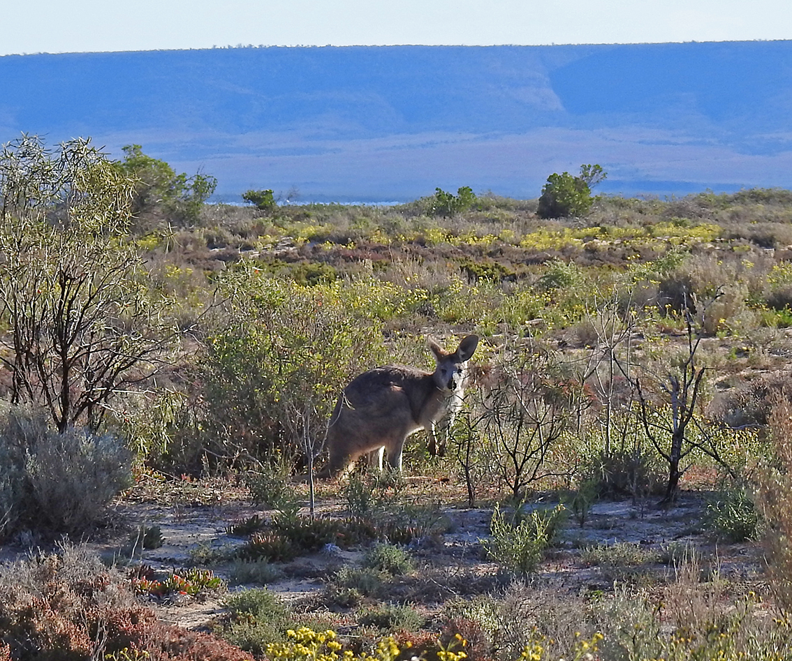
Wester Grey Kangaroo

We are not disappointed when Geoff spots a pair of glorious Blue Bonnet Parrots in a roadside tree. A few minutes later, a Western Grey Kangaroo lifts its head from feeding, twitches its radar ears and watches us drive by. A couple of wonderful encounters as we head back to the shacks for a well-earned dinner.

Driving into Commissariat Point at dusk with wind on the other side of the gulf

Cheers

BAZ

Additional notes

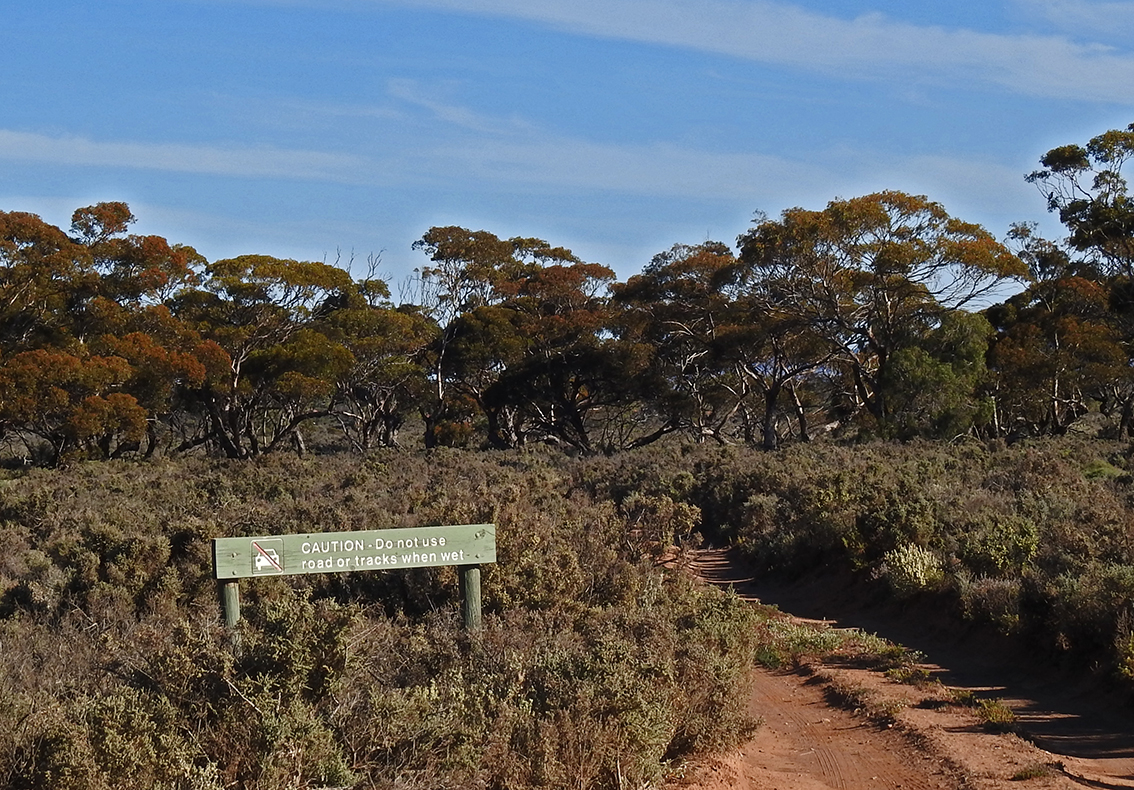
This is an easy walk/drive which is quite suitable for families and seniors. It is dog friendly.

Please pass on this blog title and or contact information (URL) to any person or organisation with an interest in taking walks and enjoying wildlife in SA.

Click on this link and see more South Australian stories and pictures in my Weekend Notes articles

https://www.weekendnotes.com/profile/651267/

Commissariat Point’s Beachside Wildlife

25 Oct

Dear Reader:

The boat is high and dry on the turning tide. Time for a stroll along the shoreline. A little exploration of the intertidal zone.

Tide is Out

Commissariat Point is a ten-minute drive south of Port Augusta near the army testing and training grounds. It is a community of shacks, some quite opulent, where a few owners live permanently while others visit or rent on weekends and holidays.

Shacks, scrub and windfarm in the evening light

These upper reaches of the Spencer Gulf are also lined with one of the State’s truly wonderful trees, the Grey Mangrove. Mangroves live between high and low water and have many adaptations to help them survive this challenging environment. They produce aerial roots called pneumatophores which help the plant to breathe in the sticky mud that is common along the shoreline. Their leaves are shiny on one side and secrete salt particles on the other.

Grey Mangroves

Mangrove leaves

There is quite a lot of seaweed around the high tide mark. It has been deposited on the beach during winter storms and is home to a variety of animals. There are worms, crabs, insects and even small lizards in this unusual habitat which retains moisture below the sun-dried outer layers.

Gecko species in seaweed

Just above the high tide mark lies a thin line of vegetation which is tolerant to the windy and salty conditions. I am quite surprised to discover some Flax Lilies growing here. The delicate flowers are attracting a few buzz-pollinating native Blue Bees. The term buzz pollinating refers to their ability to spread pollen through the high frequency beat of their wings.

Blue-banded Bee on Flax Lily

The light is starting to fade and the tide is coming in as my walk draws to an end. A few wading birds are coming closer to the shore with the incoming water and I try my luck at photographing them in the soft light. A nice way to finish my initial exploration of this tiny settlement at the head of Spencer Gulf.

Heron using feet to help scare out fish and other small animals

Cheers

Baz

Additional notes

This is an easy walk which is quite suitable for families and seniors with parking but no other facilities. It is dog friendly.

Please pass on this blog title and or contact information (URL) to any person or organisation with an interest in taking walks and enjoying wildlife in SA.

Click on this link and see more South Australian stories and pictures in my Weekend Notes articles

https://www.weekendnotes.com/profile/651267/

Torrens Island

1 Oct

Torrens Island and its causeway entrance are situated over the Torrens Island Bridge at the end of The Grand Trunkway in Port Adelaide; about a 30 minute drive from Adelaide’s CBD. The island is closed to the public but the small breakwater and causeway are open. Most of the island is a conservation park with the remaining area housing the power stations and some historic sites.

Road across breakwater looking back at hills

The island if flat and covered with mangroves, samphire and saltbush. The causeway has no vegetation. The mangroves that are accessible from the causeway and road are actually situated on Garden Island. The causeway forms a barrier between the Angas inlet on the left and the warm water outlet from the power station on the right as you face the power station.

Black-shouldered Kite perched on light pole

Numerous fish species including bream, mullet, whiting and Mulloway are attracted to the warm water. In turn, predatory birds such as: herons, pelicans, terns, gulls, cormorants and egrets are found in this area. Small mangrove crabs are found under the rocks in the intertidal region. Dolphins are not uncommon and best spotted from the bridge.  A population of common rats live among the rocks feeding on discarded bait but they are rarely seen during daylight hours.

Little Egret hunting near mangroves

The dominant vegetation seen from the causeway is the Grey Mangrove with small amounts of samphire. At low tide there are seagrass meadows visible through the fencing on the mudflats to the left facing the power station.

Mangrove leaves and fruit….note the waxy top and rough, paler underside where salt crystals accumulate.

Prior to European settlement the mangrove and samphire swamp areas were a rich hunting and gathering region for the local Kaurna people. They would have caught crabs and speared or netted fish as well as collecting shellfish.

Torrens Island power station

Torrens Island was named after Robert Torrens senior who was chairman of the SA Colonisation Commission. Between 1870 and 1980 it was a quarantine station for both animals and people entering the state. During World War 1 the island was used as an internment camp for citizens of German and Austrian backgrounds. Since 1963 much of the island and surrounding water have been protected areas and part of different marine reserves. Three power stations are operating on the island: Torrens Island PS since 1963, Quarrantine PS since 2002 and finally Barker Inlet PS since 2009. All are gas powered.

Fishing as the sun goes down

Fishing from the rocky causeway in the warm water outlet is popular. There are fine views of the ships’ graveyard and its wrecks from the bridge. Tours of the old quarantine facilities can be arranged through the maritime museum in Port Adelaide. In short, quite an interesting place to visit and combine with a day at Port Adelaide.

Cheers

Baz

Additional notes

This is an easy destination to visit and is quite suitable for families and seniors.

Please pass on this blog title and or contact information (URL) to any person or organisation with an interest in taking walks and enjoying wildlife in SA.

 Click on this link and see more South Australian stories and pictures in my Weekend Notes articles

https://www.weekendnotes.com/profile/651267/

About Port Gawler

1 Sep

Dear Reader:

For the rest of this year I will be posting occasional articles exploring some destinations along Adelaide’s coastline. They will include notes on: terrain, vegetation, common animals, history( First Nations and European) and other attractions. Port Gawler is the first in this series.

Introduction

Port Gawler is about 30 kms north-west of Adelaide’s CBD along Port Wakefield Road, Highway 1. The road from the main highway to Port Gawler has some fertile pastureland flanking it as well as mangrove and salt bush closer to the coast.

Fertile farmland on the drive into Port Gawler


Terrain

The seafront is dominated by Grey Mangroves with areas of samphire and low scrub alongside. An extensive beach area of shell grit and mud is exposed at low tide for hundreds of metres. Where the Gawler River meets the beach there is a channel. Seagrasses cover the sub-tidal region further out to sea. 

Samphire, saltbush and wetlands

Wildlife

Mangrove stands are important nursery areas for many recreational fish species such as King George Whiting, mullet species and Black Bream. Numerous marine snails, bivalves, crabs, sponges and other invertebrates live in the complex mangrove jungle and seagrass meadows. Butterflies, damselflies, dragonflies, mosquitoes and small spiders are common terrestrial invertebrates.

Masked Lapwing

Bird life in this area is prolific and includes many shore birds such as herons, oyster catchers, Black Swans, Cormorants, ibises, gulls and stilts as well as numerous migratory species including plovers and other small waders from as far away as Mongolia. Warblers, flycatchers and honeyeaters live in the dense foliage of the mangroves and are easy to recognise by their calls but hard to spot. The density of smaller birds also attracts some raptors including Nankeen Kestrels and Black-shouldered Kites. There are foxes, hares, lizards and snakes in the surrounding pasture and scrub. 

Nankeen kestrel hovering


Vegetation

The dominant plant in this region is the Grey Mangrove which grows close to the shore and extends into the shallow intertidal zone. The tubular structures that push through the mud are part of the root system called pneumatophores. They help the plant to absorb oxygen. Samphire, saltbush, pigface and other low growing hardy plants are found around the shoreline. Large amounts of seaweed are often washed up on the shore during the winter months. It is dead Posidonia or strapweed, a common sea grass along our coastline.

Grey Mangroves at low tide showing channel and pneumataphores

Mangrove fruits

History

First Nations

This was a rich area for the indigenous Kaurna people whose coastal lands stretched from Port Wakefield in the north to Cape Jervis in the south. They fished, hunted and collected shellfish and crabs from the estuary and used reeds for constructing a variety of products including fish nets and baskets.

Blue Crab

European settlement

Port Gawler was named in 1867 Governor Henry Young most likely for the earlier Governor, George Gawler. It was surveyed in 1869 and a large property of 4000 acres named Buckland Park was established along the river. The township and Lisbon Wharf became an important shipping point for grain and other produce with over 100 shallow draft ships called ketches taking their cargo to Port Adelaide. In 1920 fire destroyed the wharf and it was never rebuilt as a nearby rail link to Port Adelaide was constructed.

Remains of the old wharf system

Other notes e.g. attractions facilities

There is no township only a boat ramp, toilet block and shelter with interpretive information. Port Gawler marks the beginning of the Saphire Coast, a shallow mangrove and mud flat dominated stretch of coastline incorporating the Adelaide International Bird Sanctuary-Winaityinaityi PangkaraThere is a nearby off-road hire park for 4WD, motor bikes and go-carts. Bird watching, fishing are popular along this part of the coast. From September to April, large numbers of Blue Crabs are caught in the shallows.

I hope you enjoyed this description and plan a visit to Port Gawler in the near future. Next month’s blog I will return to my personal account style. Until then…..enjoy and protect the natural world and all it offers.

Cheers

Baz

Click on this link and see more South Australian stories and pictures in my Weekend Notes articles

https://www.weekendnotes.com/profile/651267/

Winninowie National Park and Chinaman’s Creek

3 Sep

Winninowie National Park and Chinaman’s Creek

Dear Reader:

The track to Winninowie National Park comes off the main highway between Port Germein and Port Augusta. Low flat scrub borders the road on both sides with the coast in front and the Flinders Ranges foothills behind. Barbed wire fencing keeps small groups of sheep from wandering onto the road. Crested Pigeons, Galahs and some smaller unidentifiable bird species can be seen in the scraggly bushes bordering the pasture. In the distance I can just pick out a tree-line marking the edge of the national park: from there the road meanders towards the coast.

Typical coastal scrub

 A few hundred metres past the first stands of eucalypts we come across a smaller track veering to the left. The track has a sign that warns against use in wet weather but there has been a little rain over the last few days and today is fine and clear. We slip the vehicle into 4WD low range as a precaution and with a little slippage and much lurching, explore the trail.

Grey Butcherbird 

I tap Geoff on the shoulder and ask him to stop and power down his window. Only metres from the car, a Grey Butcherbird is perched on a dead tree branch. These fascinating birds have the rather unsavoury habit of impaling their prey on sharp branches where they are stored for later consumption. A kind of avian serial killer complete with trophies.

Euro in scrub

Our next encounter is on my side of the car. I notice a flash of grey in the undergrowth. Geoff sees it too and we slide to a halt. I am expecting to see a Western Grey Kangaroo and I am pleasantly surprised to spot a Wallaroo or Euro. These robust cousin of the more common Western Grey Kangaroo are more commonly found in the higher regions of the Flinders Ranges which form a backdrop to the coastal plain we are traversing.

Crested Pigeons 

Of course, the usual wildlife is abundant here; Australian Magpies, Crested Pigeons, a variety of parrots and even some Miner Birds. There are also Emus which occasionally sprint across the trail making photographing them almost impossible. Eventually I spot a small group way out in the scrub grazing under some trees. My Nikon P900 has excellent range and I tend to use it as a spotting scope at extreme distances. I decide to take a chance; stop the car rest and squeeze. Considering the range and lighting conditions I am pleasantly surprised by the result.

Emu at distance  

The track ends at a wide expanse of shallow beach coated in seaweed with a wonderful view across Gulf St Vincent to the low hills of the Eyre Peninsula. We return along the same path and then head down to Chinaman’s Creek; a little outpost set amongst mangroves with a few shacks and a boat ramp, an area I have written about previously.

Chinaman’s Creek 

After fossicking about in the mangroves it is time to head for home and lunch at Port Germein; a good half an hour’s driving time. We decide not to stop on the return drive unless something extraordinary makes an appearance and as a parting gift, that does happen. A loan Western Grey Kangaroo bolts in front of the car and presents the perfect picture with the foothills of the Flinders in the distance. Then one final encore as lovely Red Capped Robin sits in a thorn bush near the road………a nice way to end a perfect afternoon. 

Roo in flight

Red-capped Robin

Cheers

Baz

 Additional notes

This is an easy drive in dry weather which is quite suitable for families and seniors but requires 4wd in the wet. The National Park bans Dogs. 

 Please pass on this blog title and or contact information (URL) to any person or organisation with an interest in taking walks and enjoying wildlife in SA.

See more South Australian stories and pictures in Weekend Notes

https://www.weekendnotes.com/profile/651267/

Thompson Beach Safari

5 Aug

Thompson Beach Safari

 Dear Reader:

I leave the Port Wakefield Road at the Dublin Hotel and head towards the little coastal settlement of Thompson Beach travelling along a well graded unsealed road. Although the International Bird Sanctuary is my final destination, the rural track which passes through wheat-fields, grazing land with remnant scrub and trees on its edges, provides numerous wildlife viewing opportunities. There are parrots, magpies and many smaller bird species in the trees. In the distance, I catch a glimpse of several different kinds of raptors hovering above the plains. I suspect they are Nankeen Kestrels and Black-Shouldered Kites.


Enjoyable contrasting colours and textures on the drive in


I liked the look of magpies against the grey sky

I am exploring the International Bird Sanctuary at Thompson Beach, a small township around a forty-five-minute drive north of Adelaide. Established in the 1980’s and named after a family who farmed the area in the late 1800s, it is a well-known fishing, crabbing and bird watching destination on the Samphire Coast. Samphire is a low growing coastal plant that is often found in close proximity to mangroves and shallow, saltwater wetlands.


Parked on the beach front


On reaching the coast I notice a sign that indicates two different walking and sanctuary zones. I will explore both but start with the Baker Creek area to the north. After parking the 4WD at the end of the trail I walk along the beach front and explore the intertidal zone. There are many different shells including; cockles, predatory snails and even cowries. Diminutive Sanderlings are feeding among the drifts of seaweed and further out to sea I can see both egrets and herons wading in the shallows. Small fish are schooling in the mouth of the creek and I find numerous kangaroo droppings in the scrub adjacent to the beach.


Sanderling feeding


Random collection of shells

The coastal vegetation is almost as interesting as the wildlife. There are some fascinating ground covers close to the beach. I find a late-season Painted Lady butterfly settled amongst an unusual succulent ground cover that I am yet to identify. In a nearby acacia bush, a Singing Honeyeater perches high in the foliage as the bird surveys its territory.


Painted Lady on succulent


Singing Honeyeater

I have spent a good hour enjoying the Bakers Creek part of the sanctuary and it is time to backtrack and walk along the more developed Third Creek Trail. It has more defined trails with numerous interpretive signs explaining the characteristics of both botanical and animal species.


Well interpreted walks


Black Kite

 My first animal encounter on this trail is a beautiful Black Kite walking along the beach foraging in the seaweed. As I approach, the bird takes flight and hovers above the beach for a while then moves across the scrub to hunt in a different environment. For the next half an hour the kite alternates between scrub, beach and sea gliding, hovering and occasionally diving as it hunts for prey.


Wasp species

It has been an interesting walk and although the wildlife has not been prolific it has certainly been unique and capturing images both challenging and rewarding. Before heading back to the city, by way of the local hotel for a counter lunch, I make one last foray into the scrub. I am determined to get at least one picture of an insect or spider to add a little variation to my story. After a few minutes carefully scanning the foliage, I am rewarded, A small wasp is foraging amongst the leaves of a coastal acacia shrub. Seems that lunch is on the mind of all creatures, great or small.

 Cheers

Baz

Additional notes

This is an easy walk and drive which is quite suitable for families and seniors.

On this excursion I used my Nikon Coolpix P900 exclusively as it allowed me to smoothly transition from extreme zoom to macro quickly

 Please pass on this blog title and or contact information (URL) to any person or organisation with an interest in taking walks and enjoying wildlife in SA.

 See more of my South Australian stories and pictures in Weekend Notes

https://www.weekendnotes.com/profile/651267/

Fish and Explore West Lakes Inlet

22 Jun

 Fish and Explore West Lakes Inlet 

Dear Reader:

The receding tide has left the mud flats exposed and several species of birds are making use of the food sources it presents. A Sooty Oyster Catcher is probing the mud for shellfish and a Masked Lapwing is looking for worms and other soft bodied animals. Their beaks, feet and hunting styles are well adapted for each individual diet.


Sooty Oystercatcher


Masked Lapwing


I am exploring the inlet between the Port River and West Lakes. The water flowers under Bower Road and there is access to both sides of the inlet. Lawns, shelters, public toilets and barbecues are available on the West Lakes side as well as free carparking and even a bike and skate park. Something for all the family!


Spinning for Salmon Trout


A nice Bream


On the Port side the water is flowing out swiftly and some anglers are casting for Salmon Trout while the lone fisherman on the West Lakes shore has caught a couple of sizeable Bream. The calmer waters of West Lakes allows me to explore some of the rock facings and photograph schools of small bait fish that are feeding on the surface.


Pied Cormorant


Both Black and Pied Cormorants are fishing in the area. They paddle along the surface for a while then dive and use their webbed feet and shortish wings to aid steering and propulsion underwater. Cormorants’ eyes are well adapted with special lenses that allow them to see clearly underwater. In addition, the jagged tooth like structures on the edges of their beaks enable them to grab and hold slippery fish.


Mangrove leaves and spider web


On the western side of the Port River Basin there is a significant growth of mangrove trees. They provide yet another significant environment. Numerous birds, insects, spiders and marine invertebrates inhabit this zone and it is very important as a breeding and nursery area for many marine fish species.


Small bait-fish feeding on the surface


My walk around the inlet has been most rewarding. Apart from the animals photographed I have also encountered Pelicans, Terns, Stilts and tiny Plovers. Grubbing around in the muddy areas on the fringes of the mangroves I found numerous shellfish species and some little mangrove crabs that live in holes and under rocks. 


Mangrove crab species


The West Lakes Inlet on Bower Road is certainly a diverse and interesting place to spend some time. Give it a try when you have a spare few hours.

Cheers

Baz

Additional notes

This is an easy walk/drive which is quite suitable for families and seniors with public toilets, barbecues, parking and other facilities nearby. It is dog friendly.

All the photographs for this article were taken using a Nikon Coolpix P900 

Please pass on this blog title and or contact information (URL) to any person or organisation with an interest in taking walks and enjoying wildlife in SA.

 See more South Australian stories and pictures in Weekend Notes

https://www.weekendnotes.com/profile/651267/

Middle Beach Wildlife

2 Jun

Dear Reader:

The road is paved to start with then turns into a well graded, dirt track which leads into a small beachside settlement. There is both pasture, coastal wetland and a roadside corridor of scrub and gum trees along this approach road. These distinct environments provide fertile hunting grounds for raptors and I am lucky enough to spot two species before I get to the mangrove and beach environment I have come to explore. A Brown Falcon perched on an old fencepost and a Black Shouldered Kite precariously balanced on a power line.


Black-shouldered Kite

Brown Falcon

I am exploring Middle Beach, a coastal township set amongst mangrove stands and shallow beaches; about a forty-five-minute drive from the centre of Adelaide. There is a small boat launching ramp, numerous channels that wind through the mangroves and even a public toilet in this unique setting. Middle beach is renowned for crabbing and fishing and is well worth a visit if canoeing, birdwatching or angling are your thing.


Singing Honeyeater

Grebe species

 The mangroves are home to a wide variety of animals including dozens of local and migratory birds, but they are hard to spot and even harder to photograph. However, their varied calls are a familiar soundtrack every time I visit these coastal reaches. Today I am lucky enough to see a Singing Honeyeater and Grebe as I walk up the shallow channel towards the sea.


Samphire and Mangrove

  I spend another hour combing the beach and taking a few landscape shots of the receding tide and reddish growths of Samphire. I use the extreme magnification of the camera to watch Great Egrets, White Faced Herons and Ibises in the distance as they forage in the seagrasses. Unfortunately, they are all just out of range for a good shot, even with the extraordinary telephoto capabilities of my Nikon P900.


Bovine Family Portrait

Around the water tank

On the drive back to the main freeway I decide to concentrate on photographing the rural landscape and I am rewarded by some interesting images of cows and Ibises near an old water tank and a group of cows seemingly posing for a family portrait. A great way to finish my Middle Beach excursion.

Take a drive there and let me know what you think.

Cheers

Baz

 Additional notes

This is an easy walk/drive which is quite suitable for families and seniors with public toilets, parking and other facilities nearby. It is dog friendly.

See more South Australian stories and pictures in Weekend Notes

https://www.weekendnotes.com/profile/651267/

 I have recently spent time in Africa and the link below will allow you to enjoy images and field notes describing some of my encounters with the wonderful wildlife of Botswana and Zambia. I will try to attach a new image and notes each month.

https://wildlifemomentssa.blogspot.com

Weeroona’s Wildlife

10 Aug

Dear Reader:

The roadside view makes the pair of ibis look like some multi headed ying-yang version of a bird as one looks up while the other dips its beak into a puddle. They are part of a larger group that has been feeding in the samphire wetlands that border the road to the island.


Pair of ibis


Strictly speaking Weeroona island is more like a raised peninsula; cut off from the mainland by swampy ground that only floods in severe weather conditions coupled with high tides. Situated between Port Pirie and Port Germein (about two hours drive from Adelaide) the island is a weekend destination for many locals. There are a wide variety of dwellings from beachside shacks to luxury homes scattered around the island. Surrounded by stands of mangrove and with stretches of beach mudflat and cliffs the periphery of this tiny island is a Mecca for coastal wildlife.


Island life


As I reach the island I notice a small park with children’s play equipment, shelter and barbecues. Nearby there is a boat ramp and a walking trail that skirts the mangroves. A school of mullet are feeding in the shallows and I can hear the calls of mangrove warblers and herons in the tangles of trunks and leaves that crowd the water’s edge. The view from the park back across the mainland to the lower Flinders is spectacular with low clouds enveloping the crest of the hills.


Mangrove channel


Driving around the island only takes a few minutes but there are several minor roads and tracks leading down to the sea that are well worth exploring. Along one small trail I have an uninterrupted view of the skeletal remains of an old fishing boat and a mixed accumulation of pied and black cormorants on a small exposed beach.


What a wreck


It has been a brief but exhilarating drive around the little island and I will make sure to set more time aside on my next foray into the area. But Weroona leaves me with one final avian gift. Just as I am about to drive back to the main highway a pair of masked lapwings decide to walk along the path near the walkway. Today the light is good and I manage to get a nice detailed shot of one of these wary coastal birds purposefully strutting along the gravel track.


Masked lapwing


Cheers

Baz

Whyalla’s Coastal Fringe

25 Jun

Whyalla’s Coastal Fringe

Dear Reader:

The grey kangaroo is bounding along the small levy that cuts across a shallow clay pan near the edge of a tidal flat. It stops monetarily and twitches its mobile ears, looks around, then continues on its way into the scrub alongside the raised earthen mound. I get a few seconds to make a shot and the wary marsupial is gone.

Grey kangaroo

 I am exploring the coastal fringe of Whyalla South Australia’s third most populous city. The steel and regional centre is situated near the head of Spencer Gulf on the Eyre Peninsula about 450 kms from Adelaide. The area is a mixture of mangrove, tidal flats, sandy beach and some small industrial areas that enclose substantial freshwater pools. Several roads lead down towards the coast from the Lincoln Highway and some of the terrain requires 4WD.

Garden centipede

Egyptian beetle 

I take the vehicle across one of the mud flats and have to fight to keep from getting bogged. Slipping the SUV into low range and slowly sliding across the surface I wrestle with the steering until the wheels grip sand on the edge of the levy. Relieved, I get out and survey the quagmire of clay-like debris stuck to the wheel arches. But my close call has led me to a cosy little depression amongst the scrub and I decide to move a few fallen branches and search for invertebrates. After a few minutes I unearth a rather large garden centipede and a few Egyptian or ‘cellar beetles’ as well as some different ant species. After a little macro photography I carefully replace their homes.

Australian pelicans 

Another dirt road takes me past the rifle club and some large freshwater ponds that have attracted a small group of pelicans. The birds appear to be simply congregating and socialising between short forays into the water to feed. Along the edge of the water there are several different species of small waders including dotterels and plovers but they are wary and take flight when I approach.

Crested pigeons 

The scrub alongside the mangrove patches is also home to a variety of birds including singing honeyeaters and fantails. One scrubby eucalypt that has managed to endure decades of salty onshore winds provides shelter for a trio of crested pigeons a species that I often see found foraging in the coastal bush.

View from Hummock Hill 

I head back onto the highway drive back into the city and up to a local lookout. Hummock Hill is a fitting place to end my exploration of Whyalla’s coastal fringe. The site of the first settlement in 1901 it provides panoramic views of the city, coast and surrounding bushland. Hummock Hill also served as a gun emplacement during the Second World War and has lately been developed as an historic site; lovely place to simply take in the rugged beauty that this area has to offer.

Cheers

Baz 

 I have recently spent time in Africa and the link below will allow you to enjoy images and text describing some of my encounters with the wonderful wildlife of Botswana and Zambia. I will attach a new image and notes to accompany each post.

https://wildlifemomentssa.blogspot.com

%d bloggers like this: